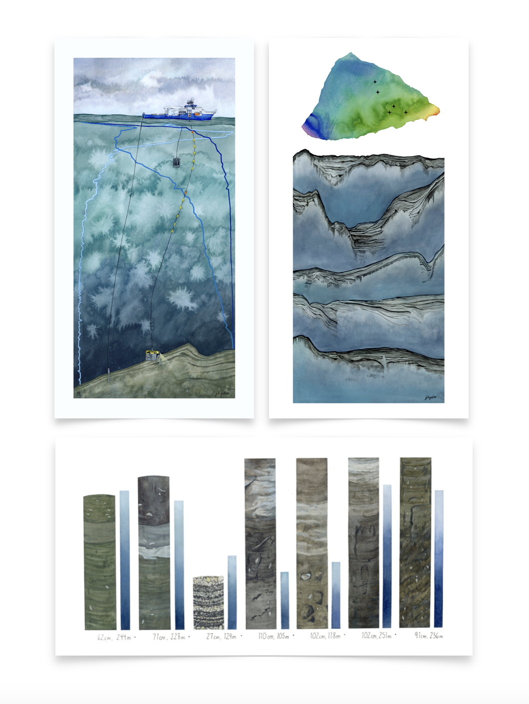
Landforms and Layers
Painting 3 of 4: Artist at Sea with Schmidt Ocean Institute
Watercolor, 22” x 10”, 2024

In September, 2024, I completed an Artist at Sea residency with Schmidt Ocean Institute. For three weeks I had the honor to live onboard the Falkor (too) off the coast of southern Chile. My role was to make art that communicated the research being done, the project was an international collaboration led by Dr. Sebastian Watt, and titled Fire and Ice: Volcanic and Glacial Interactions. Learn more about my participation here!
Mapping is constantly being done aboard the Falkor (too), and in a myriad of ways. The colorful image at the top of this piece represents a bathymetric map, which shows seafloor features from above, cooler tones represent a greater depth. This map is an area near the town of Chaitén in Chile, where most of the research for this expedition was based. The marks on it represent the approximate five locations of the mapping being shown below. These are sub-bottom profiles, in other words a side view of the seafloor and the layers of sediment beneath the surface, going down about 40 meters below. The layers are indicated by the lines, and help determine features such as deltas, landslides, dunes, and moraines. The combination of bathymetric mapping and sub-bottom profiles are crucial for understanding the history of this region and helping the research team determine where to take sediment cores.