Skykomish River Watershed
Watercolor 16” x 26”, 2025

From the Glaciers to the Sea: this is one of two paintings that tells stories of watersheds fed by North Cascade glaciers that flow out into the Puget Sound. The snowpack and glaciers in the mountains in this region provide crucial meltwater to river systems, many of which connect critically to the ocean.
The Skykomish River is located more centrally in the North Cascades, and is partially glacier fed. It joins with the Snoqualmie River and combines to form the Snohomish River, which flows into the Puget Sound near Everett.
Columbia Glacier is seen on the left of the painting, with the beautiful Blanca Lake beneath. This is one of three glaciers remaining in this region, the other five have recently disappeared. On the right side is the Alpine Lakes Wilderness, three of the nine glaciers in this complex remain. Most recently lost was the Iceworm Glacier, in 2023.
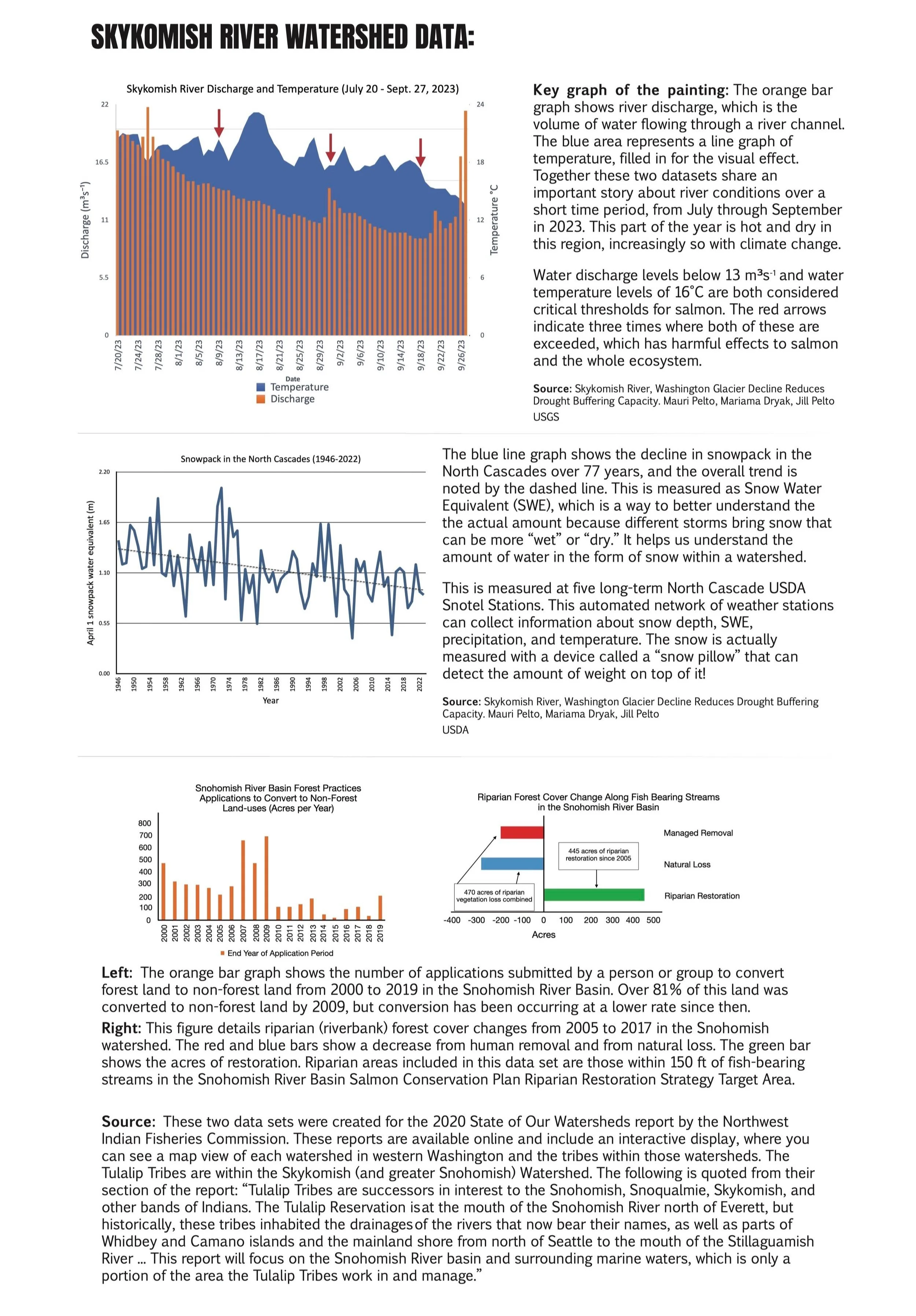
The large bar graph in this piece shows Skykomish River discharge (the volume of water) from mid July to late September in 2023. The decrease in water over the dry, hot summer period is evident. The line graph that makes up the mountain above the bars shows the temperature of the river at this same time, highlighting heat wave events. When the temperature spikes, and when the river levels drop, a critical threshold is reached for salmon and other species. This highlights the importance of glaciers in acting as a buffer during drought and heat events.
To learn about all the other data included, check out the graphic I made below!
Sources: North Cascade Glacier Climate Project (Dr. Mauri Pelto and Jill Pelto), Northwest Indian Fisheries Commission: Tulalip Tribes, GLIMS, USGS, USDA